
Start a Nicholas County Property Search
For most lookups, the WV Property Assessment search is the best first stop. One query there can return a lot. It covers the parcel identifier, owner of record, and mailing address. You also get the legal description, appraisal fields, and a deed book and page lead. Take that deed reference to the County Clerk's index. You need it to know who conveyed the land. It also shows whether a lien, easement, or correction was recorded against it. For map context, the WV Property Viewer adds helpful layers. These include the parcel outline, E-911 address, flood information, and a link to the assessment report.
Remember that the Nicholas County tax roll updates once a year. A deed recorded after that cycle may be newer than the owner field shows. The trail you assemble is a set of related property records. It is not a title opinion or a survey. Keep the legal description and parcel number beside the modern street name. This matters for rural tracts or parcels whose shape has changed over time.
- Search the state assessment form by street, owner, or district-map-parcel.
- Save the full parcel key, legal description, and deed reference from the result.
- Use the Clerk's grantor and grantee index to check the recorded transfer.
- Open the map viewer and compare the selected parcel with the deed description.
- Ask the holding office for an older book, a certified copy, or a record not shown online.
Nicholas County Property Records Offices
Nicholas County spreads its records across several custodians. Recording happens in the local Clerk's office. The Assessor maintains the roll. Statewide tools assemble county data into one place, and tax-sale research runs through the State Auditor and the Sheriff. City zoning questions belong to Summersville or Richwood. Floodplain and septic matters outside city limits stay with the county.
Nicholas County County Clerk / Deeds
700 Main Street, first floor
Summersville, WV 26651
(304) 872-7820
Nicholas County Assessor
700 Main Street, Suite 4, courthouse basement
Summersville, WV 26651
(304) 872-7800
West Virginia State Auditor
Statewide Land and County Collections application
Certified-to-state and delinquent-land searches
Confirm sale details with the Sheriff
Nicholas County Search Fields
The statewide form lets a Nicholas County property search approach the same tract. It does so from several angles. Street Name works well when you know the mailing address. An old deed often describes the land by district. Then the Full Parcel ID is the stronger key. The District, Map Number, Parcel, and Sub-Parcel fields work just as well. Owner Name can return more than one parcel at once. Appraisal and sales filters help narrow a study. Any result still needs a deed check. Only then can it answer a title question.
The WV Property Assessment form groups its controls into sections. These cover basic, appraisal and sales, advanced, and display options. The county, owner, street, parcel, and valuation controls all appear on the official page. They support that all-important first pass.
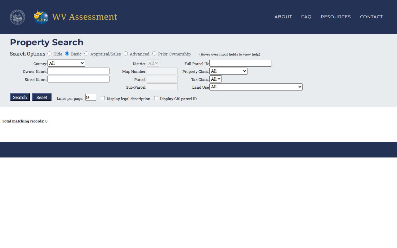
When a result shows a legal description and a deed book and page, write them down. Those details give the Clerk a far better search lead than a street name alone.
| Street Name | Starts an address-led parcel lookup; rural and renamed roads may need a map key. |
|---|---|
| Owner Name | Finds assessment entries under the recorded tax-owner name. |
| District / map / parcel | Links the assessment, map, and deed trail by local parcel key. |
| Legal description / deed book | Bridges an older conveyance to a present assessment result. |
Nicholas County Deed Index Clues
The County Clerk's compiled index reaches well beyond deeds. It also covers deeds of trust, mortgages and releases, liens, easements, plats and maps, wills, and estate instruments. Together these form a broad record of interests in Nicholas County land. The search controls include From and Thru dates, party names, party roles, record categories, document types, books, index and image modes, and a Vault Search option. Results can be exported, and duplicates removed. The portal does not state its first indexed year or its image cutover. So a calendar opening to an old date does not guarantee that every old book is online.
The Clerk's own page confirms that indexing is available online. For older references, image questions, or certified copies, visit the courthouse office at 700 Main Street. Or ask the Clerk which volume holds the item.
Open the Nicholas County recorded-document index to see its date, party, book, and document-type controls.
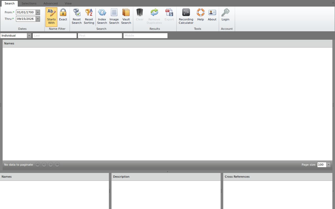
A result with no image or a blank date range is a cue to refine the search or contact the custodian. It is not proof that a transfer never happened.
Nicholas County Deed and Tax Records
A Nicholas County property search rarely stops at the transfer deed. The record type points to the custodian who can answer your next question. The map number then helps you match records that use different address formats.
| Record Type | What It Documents | Kept By | Access |
|---|---|---|---|
| Deeds and conveyances | Recorded grantor-to-grantee transfers and legal descriptions | Nicholas County Clerk | Online index; older books and certified copies through the Clerk |
| Mortgages, liens, easements | Deeds of trust, releases, encumbrances, and access rights | Nicholas County Clerk | Document and book selectors in the recorded index |
| Assessment and tax map | Owner-of-record, appraised fields, and approximate parcel geometry | County Assessor / WV portals | Public search and viewer; annual state refresh |
| Delinquent land and sale | Certified-to-state accounts, sale notices, and status leads | State Auditor / Sheriff | Statewide search; verify sale and redemption with Sheriff |
| City permits and zoning | Municipal land-use rules and any address history the city holds | Summersville or Richwood | Code pages and city contact; no public address search located |
Each record answers a different question. A deed shows who conveyed an interest, the assessor roll shows the tax owner and value fields, and the viewer places the tax-map parcel in space. For transfer history, follow the Nicholas County deed records route and compare its legal description with the parcel card.
Nicholas County Parcel Map Context
The WV Property Viewer joins county parcel geometry to assessment information in one display. Click a shape and you may see owner detail, physical and E-911 address, community, and flood information. Building information, cost values, appraised values, and delinquent status may also appear. So may a parcel assessment-report link. The map also offers Parcel, Address, and Flood Zone tools. Export controls, highlighting, and a KMZ download round it out. It is a practical way to move from one parcel number to its neighbors. Keep in mind it is still a tax map built for reference, not a survey.
Open the WV Property Viewer before you rely on any outline. The map-and-detail layout there is the same one available for Nicholas County property records.
Let the deeded acreage and the legal description explain a conveyance. Calculated acreage is only a GIS estimate, and the mapped line is not a licensed survey or a court boundary.
Nicholas County Assessment and Map Cycle
The Nicholas County Assessor sets assessed values for ad valorem tax. The office also keeps the county's tax-map boundaries current. The assessment year opens on July 1. A homestead exemption request is due by December 1, and the tax bill itself comes due April 1. Statewide assessment details in the state viewer refresh each year. New parcel geometry can lag behind in the state file, though.
When a transfer lands between July 1 and June 30, the assessor revises the tax maps. The office then submits them by February 1 of the following calendar year. That lag explains why a deed may already be recorded. Meanwhile, the owner of record on the state map still shows the prior party. Search the Clerk's deed index for a newer conveyance. Then call the Assessor at (304) 872-7800 if an assessment or map entry needs correcting.
Each of these dates answers a different question, so keep them straight. An assessment year is not a sale date. A map update is not proof that every transfer has posted.
For assessment search, the parcel viewer, FAQs and GIS resources, start at the WV Property Assessment landing page.
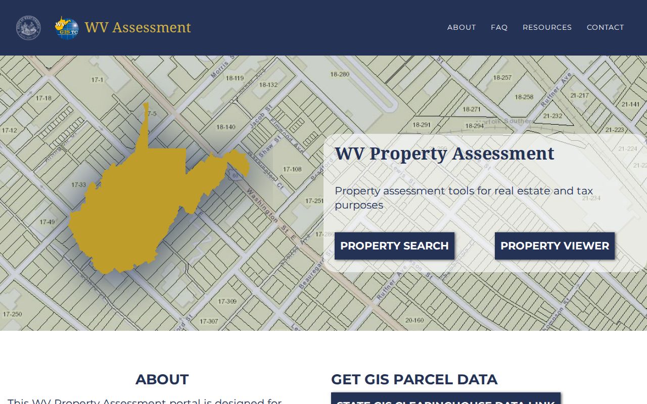
The landing page is mainly a navigation hub. For parcel-specific facts, rely on the county assessment result and the Clerk's index instead.
Nicholas County Courthouse Record History
Nicholas County was founded in 1818. Summersville became the county seat around 1820. The town incorporated in 1860. It got its stone courthouse in 1898. A major Civil War-era fire destroyed much of the town. That history matters when a house search moves from a present address back into nineteenth-century books. The Clerk's published coverage does not support assuming every early deed has a modern online image.
The recorded index names old books and historic document categories but publishes no date runs for them. Ask for a grantor and grantee index. Ask for the book and page reference, any map book or rack, and whether the record is a bound volume, microfilm, scan, or certified copy. The first courthouse was a frame building. The stone courthouse and later rebuilding mark distinct record eras. They are not guaranteed losses for any one parcel.
For Summersville clues and the city's rebuild story, compare the deed description with the county map and older local names. Do not search only a current street name.
Nicholas County Delinquent Land Records
Tax-distressed land in Nicholas County crosses four offices. These are the County Clerk, Circuit Court, State Auditor, and Sheriff. The Auditor's Land and County Collections tool searches certified-to-state records. Fields cover county, district, map, parcel, subparcel, taxpayer, purchaser, certificate, status, book and page. Its delinquent-land layer refreshes weekly, per the Viewer FAQ. A delinquent marker is only a lead. It is not a current title result or proof that a sale closed.
Review the State Auditor's Land and County Collections tool. Then confirm sale date, time, location, and redemption status with the Nicholas County Sheriff. The state page keeps public search fields separate from the notice and auction steps.
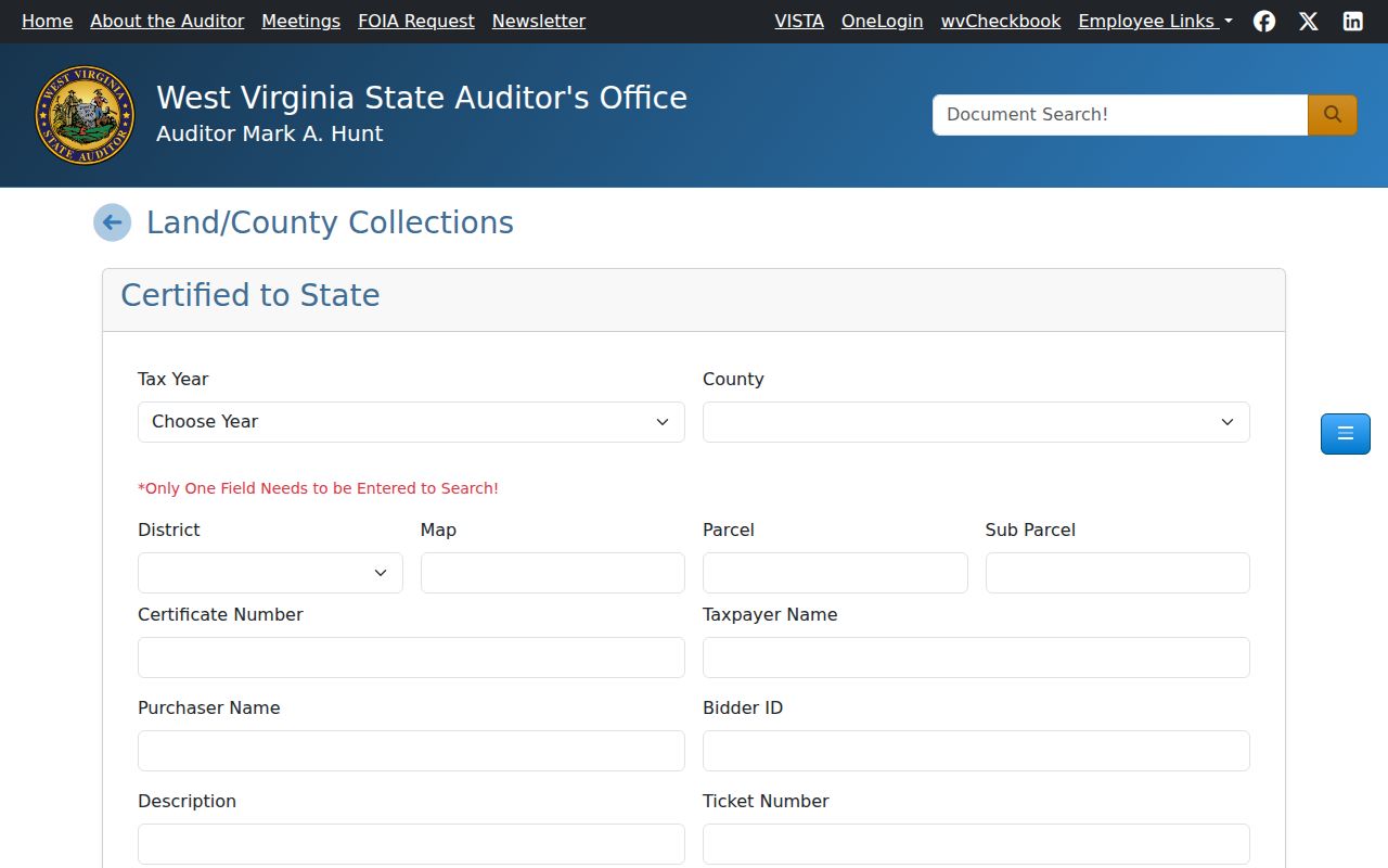
Read any tax-sale record beside later deeds, releases, notices, and court orders. Only then should anyone treat it as a completed transfer.
Nicholas County City and Rural Parcels
Summersville and Richwood have municipal zoning. The county FAQ states that no zoning regulations apply outside those city limits. A rural project can still need floodplain review and septic approval. The FAQ lists county floodplain administrators at (304) 872-7892 and (304) 872-7893, plus the Health Department septic contact at (304) 872-5329. A mailing name or ZIP, though, is not a boundary ruling.
Read the Nicholas County FAQ for those contacts and the jurisdiction note. The city zoning layer and county floodplain or septic review can each govern a different part of one property question.
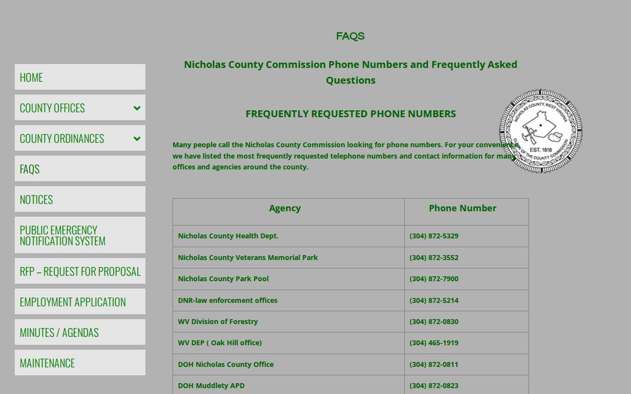
For an edge parcel, gather the city boundary evidence, county assessment map, E-911 address, deed, and the office handling the specific permit.
Nicholas County Public Record Requests
The WV Freedom of Information Act works as a fallback. It applies when the normal index or portal does not expose a record. Send a reasonably specific request to the office that holds the material. Name the parcel or owner clue, instrument type, likely date range, book and page if known, and the format you want. Under W. Va. Code §29B-1-3, the custodian must respond as soon as practicable. The response must come within five non-weekend, non-holiday days. Fees may recover actual reproduction cost, not a search or staff-hours charge.
Ask to inspect first if a copying estimate is unclear. If access is denied, request the written reason and the exemption cited under §29B-1-4. For a deed copy or an old book, the Nicholas County Clerk's counter remains the better first contact. That office can identify the record series and the current local process.
What Nicholas County Property Records Cannot Prove
Nicholas County property records can document a conveyance or an assessed value. They can also show a map parcel or a recorded claim. They cannot prove everything. No record set shows that every interest was recorded. It also cannot show that the owner of record lives at the mailing address. Nor does it prove that a tax-map line is a surveyed boundary. A court file may also hold sealed or exempt material. And a blank online result never establishes that a record did not exist.
Lawful use. Use Nicholas County owner and parcel information for property research, purchase diligence, and civic review. Do not use it to enter private land, threaten, stalk, or harass anyone.